Geography of Parthia Proper, Character of the Region, Climate,Character of the Surrounding Countries.
The broad tract of desert which, eastward of the Caspian Sea, extendsfrom the Mougbojar hills to the Indian Ocean, a distance of above 1500miles, is interrupted about midway by a strip of territory possessingfeatures of much beauty and attraction. This strip, narrow compared tothe desert on either side of it, is yet, looked at by itself, a regionof no inconsiderable dimensions, extending, as it does from east towest, a distance of 320, and from north to south of nearly 200 miles.The mountain chain, which running southward of the Caspian, skirts thegreat plateau of Iran, or Persia, on the north, broadens out, afterit passes the south-eastern corner of the sea, into a valuable andproductive mountain-region. Four or five distinct ranges here runparallel to one another, having between them latitudinal valleys, withglens transverse to their courses. The sides of the valleys are oftenwell wooded; the flat ground at the foot of the hills is fertile; waterabounds; and the streams gradually collect into rivers of a considerablesize.
The fertile territory in this quarter is further increased by theextension of cultivation to a considerable distance from the base ofthe most southern of the ranges, in the direction of the Great Iranicdesert. The mountains send down a number of small streams towardsthe south; and the water of these, judiciously husbanded by means ofreservoirs and kanats, is capable of spreading fertility over a broadbelt at the foot of the hills; which, left to nature, would be almost asbarren as the desert itself, into which it would, in fact, be absorbed.
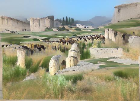
It was undoubtedly in the region which has been thus briefly describedthat the ancient home of the Parthians lay. In this neighborhood aloneare found the geographic names which the most ancient writers whomention the Parthians connect with them. Here evidently the Parthianswere settled at the time when Alexander the Great overran the East, andfirst made the Greeks thoroughly familiar with the Parthian name andterritory. Here, lastly, in the time of the highest Parthian splendorand prosperity, did a province of the Empire retain the name ofParthyene, or Parthia Proper; and here, also, in their palmiest days,did the Parthian kings continue to have a capital and a residence.
Parthia Proper, however, was at no time coextensive with the regiondescribed. A portion of that region formed the district called Hyrcania;and it is not altogether easy to determine what were the limits betweenthe two. The evidence goes, on the whole, to show that, while Hyrcanialay towards the west and north, the Parthian country was that towardsthe south and east, the valleys of the Ettrek and Gurghan constitutingthe main portions of the former, while the tracts east and south ofthose valleys, as far as the sixty-first degree of E. longitude,constituted the latter.
If the limits of Parthia Proper be thus defined, it will have nearlycorresponded to the modern Persian province of Khorasan. It will haveextended from about Damaghan (long. 54° 10') upon the west, to theHeri-rud upon the east, and have comprised the modern districts ofDamaghan, Shah-rud, Sebzawar, Nishapur, Meshed, Shebri-No, and Tersheez.Its length from east to west will have been about 300 miles, and itsaverage width about 100 or 120. It will have contained an area of about33,000 square miles, being thus about equal in size to Ireland, Bavaria,or St. Domingo.
The character of the district has been already stated in general terms;but some further particulars may now be added. It consists, in thefirst place, of a mountain and a plain region—the mountain region lyingtowards the north and the plain region towards the south. The mountainregion is composed of three main ranges, the Daman-i-Koh, or Hills ofthe Kurds, upon the north, skirting the great desert of Rharaem, theAlatagh and Meerabee mountains in the centre; and the Jaghetai orDjuvein range, upon the south, which may be regarded as continued in thehills above Tersheez and Khaff. The three ranges are parallel, runningeast and west, but with an inclination, more or less strong, to thenorth of west and the south of east. The northern and central ranges areconnected by a water-shed, which runs nearly east and west, a little tothe south of Kooshan, and separates the head streams of the Ettrek fromthose of the Meshed river. The central and southern ranges are connectedby a more decided, mountain line, a transverse ridge which runs nearlynorth and south, dividing between the waters that flow westward into theGurghan, and those which form the river of Nishapur. This conformationof the mountains leaves between the ranges three principal valleys, thevalley of Meshed towards the south-east, between the Kurdish range andthe Alatagh and Meerabee; that of Miyanabad towards the west, betweenthe Alatagh and the Jaghetai; and that of Nishapur towards the south,between the eastern end of the Jaghetai and the western flank of theMeerabee. As the valleys are three in number, so likewise are therivers, which are known respectively as the Tejend, or river of Meshed,the river of Nishapur, and the river of Miyanabad.
The Tejend, which is the principal stream of the three, rises fromseveral sources in the hills south of Kooshan, and flows with asouth-easterly course down the valley of Meshed, receiving numeroustributaries from both sides, until it reaches that city, when it bendseastward, and, finding a way through the Kurdish range, joins the courseof the Heri-rud, about long. 01° 10'. Here its direction is completelychanged. Turning at an angle, which is slightly acute, it proceeds toflow to the west of north, along the northern base of the Kurdish range,from which it receives numerous small streams, till it ends finally in alarge swamp or marsh, in lat. 39°, long. 57°, nearly. The entire lengthof the stream, including only main windings, is about 475 miles. In itslater course, however, it is often almost dry, the greater portion ofthe water being consumed in irrigation in the neighborhood of Meshed.
The river of Nishapur is formed by numerous small streams, which descendfrom the mountains that on three sides inclose that city. Its wateris at times wholly consumed in the cultivation of the plain; but thenatural course may be traced, running in a southerly and south-westerlydirection, until it debouches from the hills in the vicinity ofTersheez. The Miyanabad stream is believed to be a tributary of theGurghan. It rises from several sources in the transverse range joiningthe Alatagh to the Jaghetai, the streams from which all flow westwardin narrow valleys, uniting about long. 57° 35'. The course of the riverfrom this point to Piperne has not been traced, but it is believedto run in a general westerly direction along the southern base of theAlatagh, and to form a junction with the Gurghan a little below theruins of the same name. Its length to this point is probably about 200miles.
The elevation of the mountain chains is not great. No very remarkablepeaks occur in them; and it may be doubted whether they anywhere attaina height of above 6000 feet. They are for the most part barren andrugged, very scantily supplied with timber, and only in places capableof furnishing a tolerable pasturage to flocks and herds. The valleys,on the other hand, are rich and fertile in the extreme; that of Meshed,which extends a distance of above a hundred miles from north-westto south-east, and is from twenty to thirty miles broad, has almosteverywhere a good and deep soil, is abundantly supplied with water,and yields a plentiful return even to the simplest and most primitivecultivation. The plain about Nishapur, which is in length from eighty toninety miles, and in width from forty to sixty, boasts a still greaterfertility.
The flat country along the southern base of the mountains, which ancientwriters regard as Parthia, par excellence, is A strip of territory about300 miles long, varying in width ac cording to the labor and the skillapplied by its inhabitants to the perfecting of a system of irrigation.At present the kanats, or underground water-courses, are seldomcarried to a distance of more than a mile or two from the foot of thehills; but it is thought that anciently the cultivation was extendedconsiderably further. Ruined cities dispersed throughout the tractsufficiently indicate its capabilities, and in a few places where muchattention is paid to agriculture the results are such as to imply thatthe soil is more than ordinarily productive. The salt desert lies,however, in most places within ten or fifteen miles of the hills; andbeyond this distance it is obviously impossible that the "Atak" or"Skirt" should at any time have been inhabited.
It is evident that the entire tract above described must have been atall times a valuable and much coveted region. Compared with the arid andinhospitable deserts which adjoin it upon the north and south, Khorasan,the ancient Parthia and Hyrcania, is a terrestrial Paradise. Parthia,though scantily wooded, still produces in places the pine, the walnut,the sycamore, the ash, the poplar, the willow, the vine, the mulberry,the apricot, and numerous other fruit trees. Saffron, asafoetida, andthe gum ammoniac plant, are indigenous in parts of it. Much of the soilis suited for the cultivation of wheat, barley, and cotton. The ordinaryreturn upon wheat and barley is reckoned at ten for one. Game aboundsin the mountains, and fish in the underground water-courses. Among themineral treasures of the region may be enumerated copper, lead, iron,salt, and one of the most exquisite of gems, the turquoise. This gemdoes not appear to be mentioned by ancient writers; but it is so easilyobtainable that we can scarcely suppose it was not known from veryancient times.
The severity of the climate of Parthia is strongly stated by Justin.According to modern travellers, the winters, though protracted, arenot very inclement, the thermometer rarely sinking below ten or elevendegrees of Fahrenheit during the nights, and during the daytime rising,even in December and January, to 40° or 50°. The cold weather, however,which commences about October, continues till nearly the end of March,when storms of sleet and hail are common. Much snow falls in the earlierportion of the winter, and the valleys are scarcely clear of it tillMarch. On the mountains it remains much longer, and forms the chiefsource of supply to the rivers during the spring and the early summertime. In summer the heat is considerable, more especially in the regionknown as the "Atak;" and here, too, the unwholesome wind, which blowsfrom the southern desert, is felt from, time to time as a terriblescourge. But in the upland country the heat is at no time very intense,and the natives boast that they are not compelled by it to sleep ontheir house-tops during more than one month in the year.
The countries by which Parthia Proper was bounded were the following:Chorasmia, Margiana, Aria, Sarangia, Sagartia, and Hyrcania.
Chorasmia lay upon the north, consisting of the low tract between themost northerly of the Parthian mountain chains and the old course of theOxus. This region, which is for the most part an arid and inhospitabledesert, can at no time have maintained more than a sparse and scantypopulation. The Turkoman tribes which at the present day roam over thewaste, feeding their flocks and herds alternately on the banks of theOxus and the Tejend, or finding a bare subsistence for them about theponds and pools left by the winter rains, represent, it is probable,with sufficient faithfulness, the ancient inhabitants, who, whatevertheir race, must always have been nomads, and can never have exceededa few hundred thousands. On this side Parthia must always have beentolerably safe from attacks, unless the Cis-Oxianian tribes werereinforced, as they sometimes were, by hordes from beyond the river.
On the north-east was Margiana, sometimes regarded as a country byitself, sometimes reckoned a mere district of Bactria. This was thetract of fertile land upon the Murg-ab, or ancient Margus river, whichis known among moderns as the district of Merv. The Murg-ab is a streamflowing from the range of the Paropamisus, in a direction which is alittle east of north; it debouches from the mountains in about lat.36° 25', and thence makes its way through the desert. Before it reachesMerv, it is eighty yards wide and five feet deep, thus carrying a vastbody of water. By a judicious use of dykes and canals, this fertilizingfluid was in ancient times carried to a distance of more thantwenty-five miles from the natural course of the river; and by thesemeans an oasis was created with a circumference of above 170, andconsequently a diameter of above fifty miles. This tract, inclosed onevery side by deserts, was among the most fertile of all known regions;it was especially famous for its vines, which grew to such a size thata single man could not encircle their stems with his two arms, andbore clusters that were a yard long. Margiana possessed, however, as aseparate country, little military strength, and it was only as aportion of some larger and more populous territory that it could becomeformidable to the Parthians.
South of Margiana, and adjoining upon Parthia toward the east, was Aria,the tract which lies about the modern Herat. This was for the mostpart a mountain region, very similar in its general character to themountainous portion of Parthia, but of much smaller dimensions. Itspeople were fairly warlike; but the Parthian population was probablydouble or triple their number, and Parthia consequently had but littleto fear in this quarter.
Upon the south-east Parthia was bordered by Sarangia, the country of theSarangae, or Drangae. This appears to have been the district southof the Herat valley, reaching thence as far as the Hamoon, or Sea ofSeistan. It is a country of hills and downs, watered by a number ofsomewhat scanty streams, which flow south-westward from the Paropamisusto the Hamoon. Its population can never have been great, and they wereat no time aggressive or enterprising, so that on this side also theParthians were secure, and had to deal with no formidable neighbor.
Sagartia succeeded to Sarangia towards the west, and bordered Parthiaalong almost the whole of its southern frontier. Excepting in thevicinity of Tebbes and Toun (lat. 34°, long. 56° to 58°), thisdistrict is an absolute desert, the haunt of the gazelle and the wildass, dry, saline, and totally devoid of vegetation. The wild nomads, whowandered over its wastes, obtaining a scanty subsistence by means ofthe lasso, were few in number, scattered, and probably divided by feuds.Southern Parthia might occasionally suffer from their raids; butthey were far too weak to constitute a serious danger to the mountaincountry.
Lastly, towards the west and the north-west, Parthia was bordered byHyrcania, a region geographically in the closest connection with it,very similar in general character, but richer, warmer, and altogethermore desirable. Hyrcania was, as already observed, the western andnorth-western portion of that broad mountain region which has beendescribed as intervening between the eastern shores of the Caspianand the river Arius, or Heri-rud. It consisted mainly of the two richvalleys of the Gurghan and Ettrek, with the mountain chains inclosing ordividing them. Here on the slopes of the hills grow the oak, the beech,the elm, the alder, the wild cherry; here luxuriant vines spring fromthe soil on every side, raising themselves aloft by the aid of theirstronger sisters, and hanging in wild festoons from tree to tree;beneath their shade the ground is covered with flowers-of various kinds,primroses, violets, lilies, hyacinths, and others of unknown species;while in the flat land at the bottom of the valleys are meadows of thesoftest and the tenderest grass, capable of affording to numerousflocks and herds an excellent and unfailing pasture. Abundant game findsshelter in the forests, while towards the mouths of the rivers, wherethe ground is for the most part marshy, large herds of wild boarsare frequent; a single herd sometimes containing hundreds. AltogetherHyrcania was a most productive and desirable country, capable ofsustaining a dense population, and well deserving Strabo's descriptionof it as "highly favored of Heaven." The area of the country was,however, small, probably not much exceeding one half that of ParthiaProper; and thus the people were not sufficiently numerous to cause theParthians much apprehension.
The situation and character of Parthia thus, on the whole, favored herbecoming an imperial power. She had abundant resources within herself;she had a territory apt for the production of a hardy race of men; andshe had no neighbors of sufficient strength to keep her down, whenshe once developed the desire to become dominant. Surprise has beenexpressed at her rise. But it is perhaps more astonishing that shepassed so many centuries in obscurity before she became an importantstate, than that she raised herself at last to the first position amongthe Oriental nations. Her ambition and her material strength were plantsof slow growth; it took several hundreds of years for them to attainmaturity: when, however, this point was reached, the circumstancesof her geographical position stood her in good stead, and enabled herrapidly to extend her way over the greater portion of Western Asia.